
Day 1
Today, we are driving 140 miles north west to Lake Tahoe. Today is also daughter No 2’s birthday, so she starts the morning in style eating last night’s ice cream. With a stick. Meanwhile, the rest of us have our delicious Best Western grab & go breakfast to look forward to; 2 long life muffins, a satsuma and a fluorescent yoghurt!

After our tasty and nutritious breakfast, we set off in the direction of Lake Tahoe. Loading the car takes a while. It’s fair to say that there’s been an over purchase on the snack front (or perhaps an under consumption, depending on your point of view).

We are soon out of wine country and driving through olive groves and nut trees, past the urban sprawl of Sacramento, onwards and upwards to today’s first stop; El Dorado National Forest. We park by the ranger station – according to the internet, a source of maps and information. It’s closed. The map box outside is empty, but there are some newspapers which contain a very rudimentary map. We start walking along what appears (on the rubbish map) to be a trail to a waterfall. Pretty soon we reach a ‘keep out’ sign and a lot of smoke and burning wood. Two firemen appear and attempt to give us directions. Each gives very detailed and very different directions. The result, not surprisingly, is that we get lost. The others attempt to walk in the opposite direction. I’m over aimless wandering in the forest and volunteer to guard the car (and the crisps).

We’re parked next to a log flume, which the fireman told us was ‘pretty cool’. It’s actually empty. A fireman, in a forest, lighting fires, with poor knowledge of water sources!
After a delicious lunch (cold cheesy chips and Oreos) in a clearing in the forest, we drive the final 40 miles to South Lake Tahoe. It’s a spectacular drive along the banks of South Fork American River, running parallel to the old Pony Express Trail. As a child, Buffalo Bill used to ride the mail to the gold rush towns along here.

We climb and climb through breathtaking scenery. The road contains several sections of contraflow, where we must drive in convoy following a pilot car, so no opportunity to stop – all the lay-bys are cordoned off. So, we crawl along, cameras hanging out of the windows.
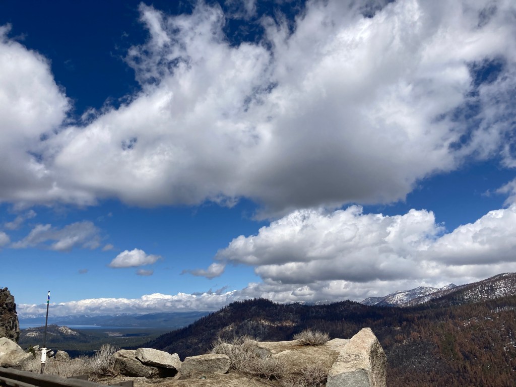
Finally, we reach the summit at 7300 feet and start to descend towards the lake. We reach our hotel; Motel 6, which has an unsettlingly large number of bear warnings posted around the grounds.

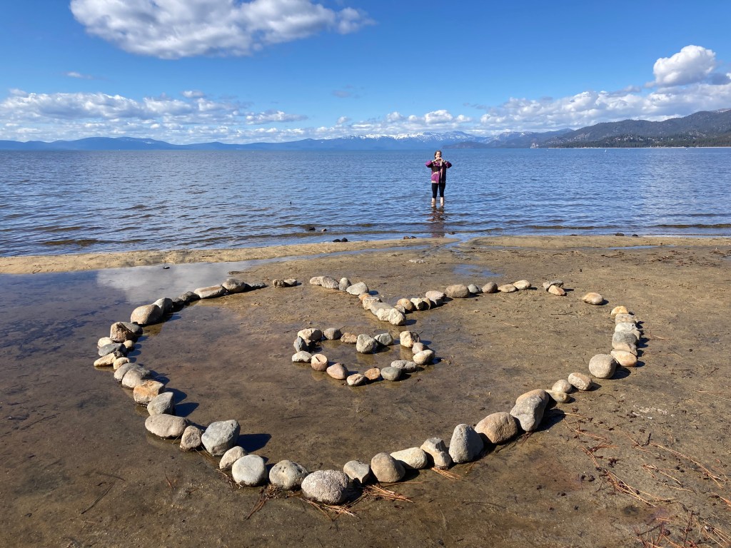
The initial plan was to drive the 2.5 miles to the lake, but the kids have other ideas and determine to walk. I’m far from convinced as we set off and moan (a lot) about it being a long way and America not being equipped for walkers as we walk along the cycle trail, as there are no pavements. Finally, we reach the lake and descend some very snowy steps to the beach. I sink into a snow drift up to my knees and get completely soaked.

It’s very beautiful on the beach, but there’s no way I’m going to attempt to climb back up through the snow drift so we edge our way along past private jetties and stairways trying to find another public access point. Finally we find one and set off on the long walk back to the motel.

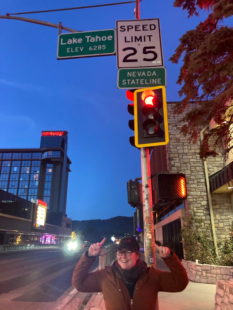
We decide to drive towards the Nevada state line for dinner and end up in the ski resort of Heavenly at Basecamp pizza. I have a pear and Gorgonzola pizza topped with rocket and balsamic vinegar. It’s very tasty, which is good as it’s probably the most expensive pizza I’ve ever eaten. And the suggested tip is 25%. Only in America would it be acceptable to request $10 just to bring a pizza from the kitchen to your table!

After dinner we walk to the state line which has a disappointing lack of state line signage and then to the lake, which is all fenced off so we can’t actually get anywhere near it. By the time we reach the car we’ve walked a total of 12 miles today and I am totally exhausted.
Day 2
We survived the night which is a relief as it’s minus 2 degrees and daughter No 2 turned the heating off because the noise was bothering her.

Today we are driving around the west of Lake Tahoe to walk some trails and enjoy the scenery. Although it’s stunningly beautiful, its also very seasonal and everything is shut.

According to its website, our first stop; Tallac Historic Site is closed, but the car park is open and you are welcome to wander around the grounds. Not true – the car park is locked and it’s illegal to stop on the road, so we continue to our second stop; Inspiration Point.
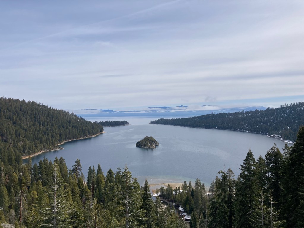
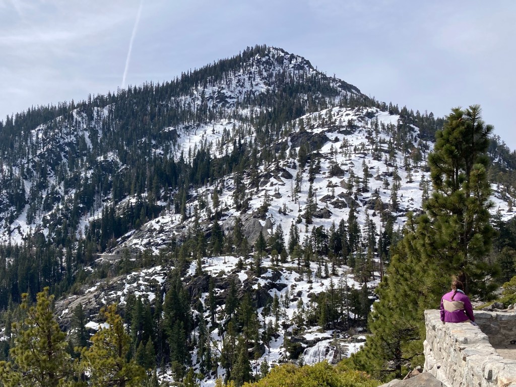
Inspiration Point is a viewpoint overlooking the lake, Fannette Island and Vikingsholm. The car park here is also closed. I don’t understand why you would close the car park to a viewpoint? There are plenty of people stopping anyway, just parking on the road, which is much more dangerous. It certainly is a spectacular view.
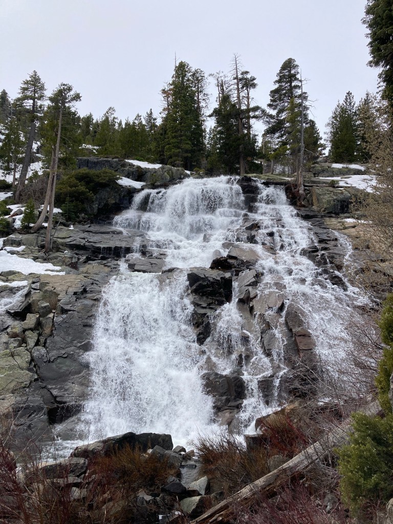
After a brief photo stop at a roadside waterfall, we continue to Emerald Bay to visit Vikingholm; built in 1929 in a Scandinavian style, it was the home to some wealthy American woman. Here, the house and facilities are also closed, but the car park is open. However, as you need to pay by phone and we don’t have an American SIM, we end up parked on the road (again).

The walk to the house is described as a steep one mile trail. There are multiple warnings about not attempting it unless you’re physically fit and confident of being able to make the return ascent. In my mind, I am imagining something way more hard core than the gently sloping road we encounter.

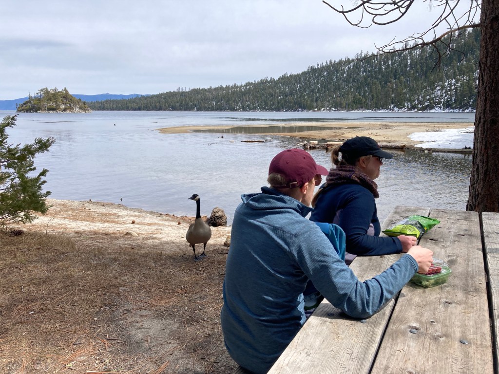
We walk down to the bottom, then follow another trail to the beautiful Eagle Falls waterfall. Then we return to the lake for a picnic lunch, which is very pleasant until we come to the attention of some Canada Geese who are very keen to join the picnic.
Before setting off on the walk back up the hill, I go to the toilet, which is grim. I perch between the poo on the back of the seat and the blood on the front, while trying not the breathe! Daughter No 2 takes one look and goes to the men’s toilets instead.
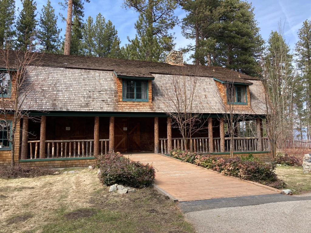
After we have walked back up to the road, which really isn’t that steep or demanding, we drive back down to South Lake Tahoe. This time, we manage to find a parking space at the Tallac Historic Site and take a walk around the various summer residences of wealthy Americans of the 1920s; the Baldwin Estate, the Pope Estate and the Valhalla Estate. Then it’s back to the hotel for curry and an early night as we have to be up early tomorrow.
I hope you found the above information useful. For guides to more destinations in the 50+ countries we have visited, check out my full list of Independent Travel Itineraries here.
- Trip taken: March 2023
- Updated: December 2024
More Blogs about the USA
California
- California Route 1 Road Trip (San Francisco to San Luis Obispo)
- Folsom in 1 Day
- La Jolla in 1 Day
- Mariposa in 1 Day
- Napa in 2 Days
- Palo Alto in 2 Days
- San Francisco in 3 Days
- Sonoma in 1 Day
- Temecula in 2 Days
Hawaii
- O‘ahu 1 Week Itinerary

Leave a comment